|
LIVE SAN DIEGO WEATHER SATELLITE IMAGE |

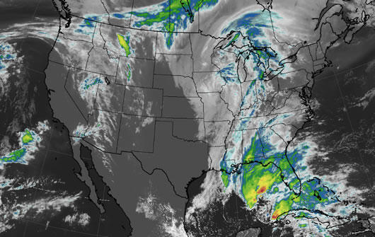
San Diego weather satellite image
What is a San Diego weather satellite
Weather satellites are used to monitor the weather and climate of the Earth. Unlike the San Diego weather radar map, the San Diego weather satellite image shows clouds and cloud systems.
And, the San Diego satellite image displays much more including: city lights, fires, effects of pollution, auroras, sand and dust storms, snow cover, ice mapping, boundaries of ocean currents and energy flows. Many other types of environmental information can be collected using the San Diego weather satellite system.
How to use the San Diego weather satellite image
This infra-red San Diego weather satellite view depicts the clouds and cloud formations by relative temperature. The lower layers of clouds, which are generally warmer in temperature are colored white. Higher clouds are usually colder and are highlighted in colors that range from orange to red to purple. Infrared satellite imagery can determine cloud features both at day and night.
The San Diego weather satellite image and San Diego weather radar map are important tools used to predict the San Diego weather forecast for the different San Diego microclimates.
|
�

Want more information about the San Diego weather?
 Click here to see the latest San Diego weather forecast. Click here to see the latest San Diego weather forecast.
|
|